
Tai Cham Koi, Tai Mun Shan
Route
Pak Tai Chung>Man Yee Au>Tai Cham Koi> Pai Ngak Shan> Tai Mun Shan>Tai Long Au>Chek Keng>Pak Tam Au
Recommendation
★★★☆☆
Difficulty
★★★★☆
Length
12 KM
Duration
5.5 hours
Support
Store at Pak Tai Chung (Start Point)
Restaurant at Chek Keng
Vending Machine at Pak Tam Au (End Point)
Transport
Start Point
Bus (KMB) No. 94, 96R and 289R (Link Click Here), alighting at Pak Tam Chung
End Point
Bus (KMB) No. 94, 96R and 289R (Link Click Here)
Map (reference only)
Tai Cham Koi and Tai Mun Shan are located in Sai Kung East Country Park, with a height of 408 meters and 370 meters respectively. During the Lunar New Year period, there are numerous “Chinese New Year Flowers” around the summit of Tai Cham Koi. Tai Mun Shan, it is named “Hong Kong Bermuda”, as there were some strange missing person cases, it is the most mysterious hiking place in Hong Kong.
There are splendid wide views of High Land Reservoir along the ridge of Tai Cham Koi, and it can overlook the Sharp Peak on the hilltop of Tai Mun Shan, the views of the trail is quite nice.
The first part Tai Cham Koi needs to walk uphill to the summit from the sea level, the difficulty is moderate as it is a paved official hiking trail. But the trail of Tai Mun Shan is unpaved unofficial trail with dense grasses and scrubs, the paths are not clear and there are a lot of forks to different directions. It has to walk accompanied with experienced hikers.
Get off at Pak Tai Chung bus stop
Walk along Tai Mong Tsai Road to the Maclehose Trail start point, and walk ahead to Man Yee Au
Before the roundabout of Man Yee Au, move to the staircase on the left side in the photo to Tai Cham Koi

There are grand views of High Land Reservoir along the ridge to Tai Cham Koi
The summit of Tai Cham Koi, with a height of 408 meters
Walk downhill after the summit
Turn left at this fork
Overlooking the Pai Ngak Shan

The Chinese New Year Flower (Enkianthus quinqueflorus) is all around in Tai Cham Koi during the Chinese New Year period (January and February)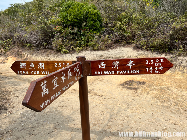
Walk toward Sai Wan Pavilion at the junction of Luk Wu Country Trail
The way to Pai Ngak Shan will be the left side after the distance post C5306
Change to the unpaved path to Pai Ngak Shan after the distance post C5306
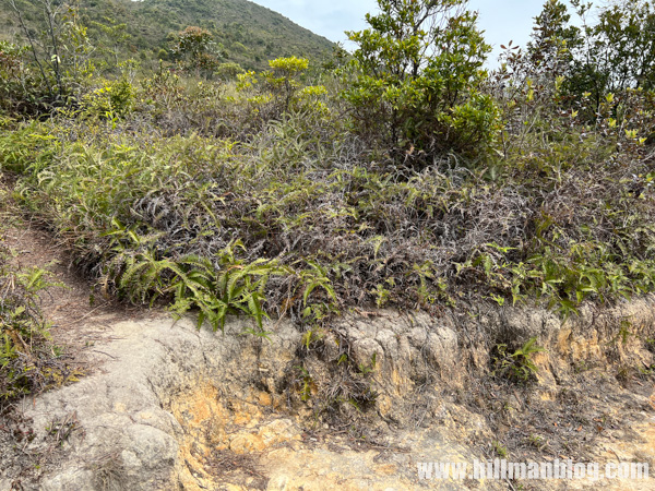
The paths to Pai Ngak Shan are not very clear, look at the summit to mark the direct
The summit of Pai Ngak Shan, with a height of 408 meters, no trigonometrical station on the summit
Use the path on the right side after the summit to Tai Mun Shan
Turn left after meeting the Luk Wu Country Trail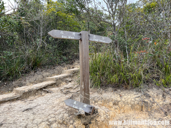
Walk toward Chek Keng

Move to unpaved path on the right side in the photo to Tai Mun Shan
There are tons of small path along the ridge of Tai Mun Shan, keep walking to left side, but it has to keep locating the summit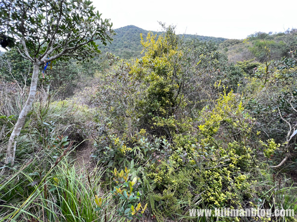
It will be dense grasses and scrubs nearby the summit of Tai Mun Shan
The summit if Tai Mun Shan, with a height of 370 meters
Walk the path on the left in the photo to Tai Long Au

The condition of the path from Tai Mun Shan to Tai Long Au is much better
and it can overlook the Sharp Peak
Tai Long Au, come back to Maclehose Trail again
It will walk to Chek keng in this blog
Chek keng
Come to an end at Pak Tam Au
0 Comments